Loading Images
Please bear with us...
Information
St. Mary's is located to the west of Gloucester Cathedral, immediately outside the cathedral precinct, and is home to twelve listed sites in nine separate listings. St. Mary's Square lies opposite the cathedral's 12th/13th-century St. Mary's Gate, separated from the cathedral by streets which run along the line of the original abbey (now cathedral) precinct wall.
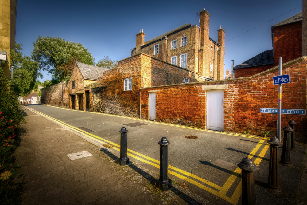
Three Cocks Lane runs southwards from the square to Westgate Street. The name is derived from the Three Cocks Inn, which was reported in 1724 to be used by clergy travelling between Oxford and South Wales. In 1316 the route was known as Abbey Lane and 1649 it was known as Portcullis Lane.
St. Mary's Street today runs north from the square, past St. Oswald's Priory to the junction with modern-day Gouda Way and Priory Road. Previously the road from the square to Pitt Street was known as Half Street (recorded as such in 1589 and 1852), while the stretch onwards from Pitt Street was known as Water Street, an evolution of Wateringstead or Watering Street recorded in 1350 and 1728.
Long before the construction of Gouda Way and Priory Road, Water Street ran from the Blind Gate in the northwest corner of the cathedral precinct wall (on the corner where Pitt and St. Mary's Streets now meet) all the way to Alvin Gate at the top of Hare Lane, one of the ten gates of Gloucestyer. That route survives today as Dean's Walk and St. Catherine Street. The name betrays the proximity of the Old Severn, a long-since dried up channel of the River Severn that once flowed to the north and west of St. Oswald's Priory and to the west of St. Mary de Lode, close enough for both to have once established quays on its banks.
St. Mary's Square
The name St. Mary de Lode, the church in St. Mary's Square, is another indication of the proximity of the former river channel, the word lode meaning a passage across a river. This name is first recorded in 1523, the church having been previously known as St. Mary before the abbey gate. The church is the elder of the area, with a history to rival that of the Cathedral.
At the beginning of the Norman period, when the first stones of today's Cathedral were laid, St. Mary de Lode served as the parish church for the abbey's extensive lands in and around Gloucester. The church was once surrounded by a graveyard, having received burial rights as far back as the late Anglo-Saxon period and being by c.1100 one of only three of ten churches in Gloucester to hold the right of baptism and burial, alongside the abbey and St. Oswald's Priory.
On the east side of St. Mary's Square, facing Bishop Hooper's memorial, is the 12th-century St. Mary's Gate. This was the original main entrance into the abbey precinct, looking today much as it did after being re-fronted and heightened in the 13th century. To its right is a clearer view of the timber-framed no. 14 College Green than can be had from inside the Cathedral precinct. Built in the early 15th century, this house pre-dates by a decade or so the cathedral tower seen peeking out above it when viewed from St. Mary's Square. It incorporates elements of an even earlier building, possibly the Almonry from where alms were distributed through the now bricked up doors in the side of St. Mary's Gate.
An open space between graveyard and St. Mary's Gate, known in the 19th century as the Knapp, was where John Hooper, the Protestant former Bishop of Gloucester was burned at the stake in 1555 on the orders of the Catholic Queen Mary I. In 1826 a small tomb was placed to commemorate Bishop Hooper on the site of his martyring. When the graveyard was enlarged to include the Knapp in 1842, a charred oak post, presumed to have been used in the execution of Hooper and currently held by the Folk of Gloucester, was unearthed. In 1863 the more substantial monument to Bishop Hooper that stands to this day was unveiled.
A 12th-century abbey lease and maps of 1610 and 1712 show that properties have long existed around church and graveyard, among them two alehouses shown in 1712 in the western part of the yard which were demolished in 1861. The graveyard was used until 1854, and gravestones could still be seen in the 1930s.
In the mid-20th century, post-war redevelopment altered the square considerably. Old buildings were replaced by modern housing, gravestones were removed and the occupants of the plots they marked reinterred elsewhere. It's almost certain that numerous unmarked burials still lie in the former graveyard which, with the exception of Hooper's statue, was sold in 1956 to Gloucester City Council.
The lone survivor of the 20th-century clearance is no. 7 St. Mary's Square on the southern edge of the former graveyard, originally built c.1690 as a townhouse and subsequently converted to offices.
Tucked away in a corner farther north and surrounded by apartment blocks is a damaged and badly decayed statue of King Charles II. Prudently commissioned 1662 by the elders of a city that had only two decades previously successfully defied the King's father during the siege of Gloucester, the statue had originally been erected in the Wheat Market on Southgate Street. When the market was demolished in the mid-18th century, the statue went missing. It was rediscovered in 1945 in pieces at "Chex Hill" (presumably Chaxhill near Westbury-on-Severn, in the Forest of Dean district, appropriately enough, given the support King Charles I had from the Forest during the English Civil War), and re-erected in its current location in 1960.
Three Cocks Lane and St. Mary's Street
Top of St. Mary's Street
Properties lining the west side of the former Great Court (today's College Green) inside the Cathedral precinct back on to Three Cocks Lane, St. Mary's Square and St. Mary's Street as far down as its junction with Pitt Street. Most were built in the 18th century, though from Three Cocks Lane there is a partial view above the high wall of the originally 15th-century nos. 1–3 College Yard (a wing of no. 8 College Green not visible from inside the precinct) and a 16th-century outbuilding with second-storey loading door backing onto the lane (also part of no. 8).
Adjoing St. Mary's Gate on the north side, at the start of St. Mary's Street, Monument House was built 1770 as a townhouse. It possibly incorporates an earlier structure according to Historic England, or was "rebuilt" 1774 according to the Victoria County History encyclopaedia.
Views of the rears of the 18th-century Deanery and the Old Mill House around the former abbey inner court (today's Miller's Green) and the 19th-century former Bishop's Palace (now part of King's School) can be had along St. Mary's Street. On the corner with Pitt Street, where there is today a service gate into King's School, there used to be a gate into the abbey precinct that was known in 1447 as the Blind Gate, but this had been pulled down by 1783.
On the opposite side of Pitt Street to where the Blind Gate once stood is the first of a row of five listed properties lining St. Mary's Street opposite the ruins of St. Oswald's Priory. Today's Pelican Inn was originally built in the 17th-century as a pair of houses and converted to a public house previously known as the College Arms in the early 20th century. Next door, no. 6 was built in the early 19th century, nos. 8 and 10 are originally 16th-century cottages, and no. 12 on the end is late-18th century.
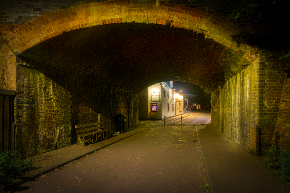
Dean's Walk
Although not listed by Historic England, Dean's Walk, across Gouda Way and under the railway viaduct, has some historical pedigree as the path used by clergy between the abbey's Blind Gate and Kingsholm Palace, the former Saxon royal palace in the vicinity of today's rugby stadium.