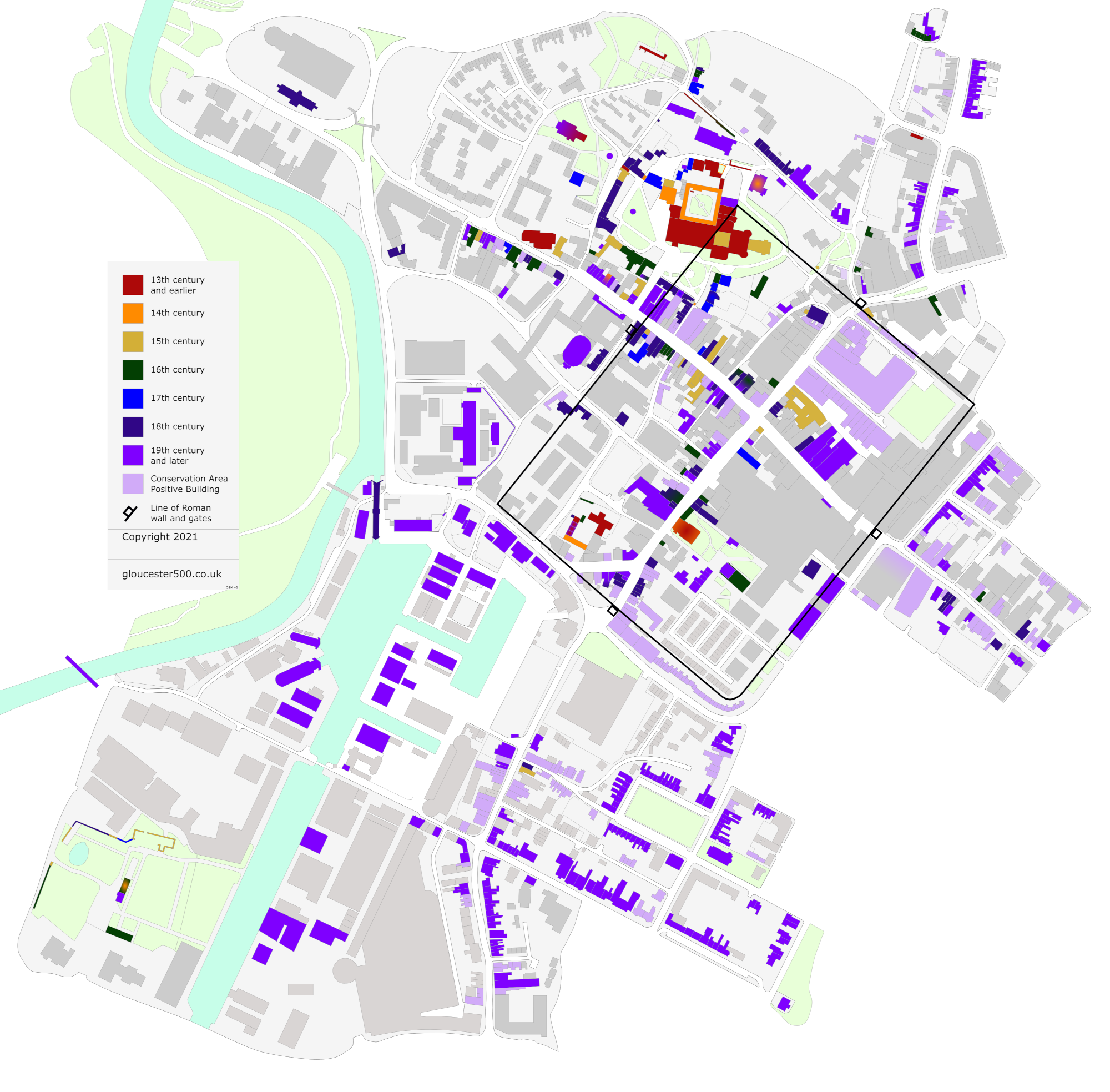
Map of listed structures in central Gloucester, colour-coded by century per the information in the Historic England listings. The map also shows buildings that have been identified as positive in Council Conservation Area planning documents.
Colours are assigned based on the century the current structure was substantially built. The incorporation of minor or uncertain parts of earlier structures, often found in properties along Westgate Street, and later alterations are not taken into account.
Thus, for example, no. 6 Westgate Street is 18th-century indigo, even though it may incorporate parts of an earlier, possibly 16th-century structure. Dick Whittington's is 15th-century yellow, despite its 18th-century façade.
An exception to the above is where Historic England reports, with certainty, substantial parts of earlier structures incorporated into later builds, in which case a graduated colour has been applied.
For example, the 19th-century violet of no. 76 Westgate Street graduates to orange at the rear due to substantial parts of the earlier merchant's house still surviving there. Another example is the 19th-century violet of houses at Blackfriars, which graduates to a red centre to reflect the 13th-century friary's west range which remains at the core of these modern conversions.
An exception to the exception is the cathedral. The first stone was laid 1089, but major works continued for another four centuries; the west elevation, south porch, tower and Lady Chapel we see today are all 15th century. It would be unnecessarily complicated to reflect all of that.
The basic street layout and some buildings were traced in InkScape from OpenStreetMap, with missing information estimated by eye using Google Maps Satellite and Street views.
Listing data is sourced from Historic England.
Conservation Area data is sourced from Gloucester City Council planning documents.
This map is, like all images on this website, subject to copyright.