Loading Images
Please bear with us...
Information
London Road is one of the historic routes out of Gloucester, having begun life in the 1st century as Ermin Street, the Roman road to Cirencester. Curiously, given that Roman roads famously run straight as a die, it runs towards the north of the city centre before turning at Wotton to reach the north gate. This anomaly led to the theory that the Roman fort which became Gloucester was not the first, and after some digging archaeologists found the earlier fort at Kingsholm, on the direct line of Ermin Street.
In the medieval period, the Saxons and their Norman conquerors extended Gloucester outside the Roman walls to the north along the London road, but only so far as the River Twyver. The outer north gate stood where the river crossed the London Road, where today the road ends at the junction with Northgate Street, Black Dog Way and Bruton Way. The land beyond the gate remained rural, and the few properties built along the road just outside the north gate were torched at the start of the siege of Gloucester in 1643 during the English Civil War.
Those properties were generally not rebuilt after the war, and a 1780 map shows only a small concentration of buildings immediately outside the gate, between today's railway and inner ring road, and a few isolated roadside properties farther out. In 1868 the Roman Catholic Church of St. Peter was completed between railway and Black Dog Inn. The pub lives on in name courtesy of Black Dog Way, the 1960s-built inner ring road that runs through the site once occupied by the inn. The church was joined c.1880 by a Presbytery. A short distance the other side of the railway, on the way out of the city centre, a rare pre-19th century property can be found today in Northgate House, originally built as a house in the mid to late 17th century and re-fronted in the 18th century.
The urbanisation of London Road began in the early 19th century as Gloucester's population entered a long period of growth that continues to this day. The construction of Wellington Parade in 1814, a terrace of four houses (later sub-divided to make seven residences) bookended on London Road by Sheraton House, was followed the next year by Nos. 20 and 22 London Road, next door to Sheraton House. Substantial villas were built a little farther out around 1820, among them the still standing Claremont House, opposite today's bus depot, and Malvern House, today's St. Nicholas House next door to the depot. Coburg Place, a large semi-detached, brick-built property appeared the other side of St. Nicholas House at the same time, and survives today as Nos. 49 and 51.
Around 1825, a substantial townhouse at the far end of Wellington Parade continued the Napoleonic theme, being named Picton House after the only British general to have been killed in the Battle of Waterloo ten years previously (Picton commanded the 5th Division at Waterloo, in which served the 28th (North Gloucestershire) Regiment of Foot, one of the two regiments that would later form the Gloucestershire Regiment). At the same time, a villa which survives today as The Elms was built the opposite side of the road to Coburg Place.
The construction of Oxford Street off London Road was under way between 1823 and 1825. Unlike the neighbouring area of Clapham, where properties were small, densely packed and the work of a variety of contractors, Oxford Street had been developed by a local attorney as a single plot. The terraced properties were a more uniform stuccoed appearance and offered higher standards of accommodation.
Farther up London Road, a short distance west of the junction with Denmark Road (which follows the original line of Ermin Street to Kingsholm and is labelled on a 19th-century OS map as "Roman Road"), two terraces dating to 1827 flank today's Gloucester Charities Trust complex for the elderly: the eight properties of Hillfield Parade to the east and the seven properties of the York Buildings to the west. Two of the York Buildings have been incorporated into the neighbouring Edward Hotel, originally built c.1790 as a townhouse.
The Gloucester Charities Trust complex, comprising St. Margaret's Retirement Home and Magdalen Nursing Home, was built 1861 as almshouses on the site of the leper hospital of St. Margaret and St. Sepulchure, first recorded in 1163. The hospital's 14th-century St. Margaret's Chapel still occupies a corner in the grounds of today's complex.
Across the road from Hillfield Parade, the still opulent looking Hillfield House was built c.1820. While the villa is private property, its extensive gardens are now a public green space, home to five listed structures. One of them, the surviving chancel of an otherwise demolished chapel of the former St. Mary Magdelene leper hospital, is the oldest structure along London Road, having been originally built in the mid-12th century.
St. Catharine's Church sits on the spur of land between the junctions with Denmark Road and Cheltenham Road. It was completed in 1915, the latest in a storied history of the differently spelled St. Catherine's Parish. After the dissolution of the monasteries, the north aisle of St. Oswald's Priory church was retained as the St. Catherine's parish church while most of the rest of the priory was demolished. That church was so severely damaged during the siege of Gloucester in 1643 that it was used as a source of stone for repairs to Westgate Bridge, Horton Road and London Road, leaving the ruin we know today. It wasn't until 1868 that a new church was built next to the ruins at St. Oswald's, only to be demolished six years after its replacement on London Road was completed.
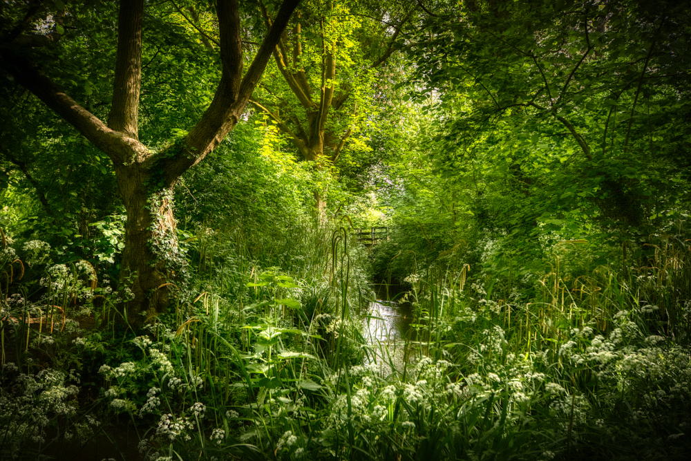
Wotton Brook
Opposite St. Catharine's are two more listed properties: Wotton Rise, built c.1825, and its brick-construction neighbour No. 138, built c.1820. The final listed property to be found on London Road before it becomes Barnwood Road at the Estcourt Road roundabout is Parkfield, a house originally built c.1800. A few steps beyond the roundabout flows Wotton Brook, which in 1874 became the City of Gloucester's eastern limit until the boundary at this point was extended again in 1935.
Roman Catholic Church of St. Peter
Northgate House, 19 London Road
Picton House, Wellington Parade
Sheraton House, 18 London Road
Former Victoria Inn, 22 Oxford Street
Claremont House, 42 London Road
St. Nicholas House, 47 London Road
York Buildings, 78–90 London Road
Gloucester Charities Trust former Almshouses
100–102 London Road (Hillfield Parade)
104–116 London Road (Hillfield Parade)
118 London Road (Hillfield Parade)